Cyclists.com

Melrose to Paxton

Melrose, Scottish Borders, United KingdomRoad

Signed route The waymarked Border Loop (Scottish Borders Council BL), traced from OpenStreetMap and measured against the terrain model; no member has recorded it yet. Stage 4 of 4 of the Border Loop. Ridden it? Add your recording and photos.

110 km
Distance
969 m
Elevation gain
Hard
Difficulty
Paved
Surface
Download GPXMap

Elevation profile

Total ascent
969 m
Distance
110 km
050100150200250m0 km255075110 km233 m · highest, at 74.2 kmStartFinish

Route overview

Suitable for riders prepared for a long 110 km route with nearly 1000 m climbing.

Stage 4 of 4 of the Border Loop: 110.2 km from Melrose to Paxton with 969 m of climbing, on the signed route.

The route starts in Melrose and begins with a 2.1 km climb gaining 57 m at an average gradient of 2.8%, reaching 155 m elevation. Riding mostly on minor and main roads, the route passes through several small places including Newstead, Dryburgh, and Bemersyde with hills like Bass Hill near 5.9 km and Brotherstone Hill around 13 km. There are scattered cafes and shops near the start and at some villages, but a long 25.4 km stretch from 21.2 km to 46.6 km without amenities requires preparation. Climbing continues intermittently with notable climbs at 5.7 km (2.6 km length, 93 m gain) and at 52.5 km with a 6% average gradient over 1.7 km including a maximum of 11%. Other climbs include sections around 69.6 km and 90.5 km. The route reaches its highest point at 233 m near 72.6 km before descending to a low of 3 m at 89 km and finishing at Paxton. The surface is predominantly paved (98%) with only 1% gravel or unpaved, and road types include 63% minor roads, 30% main roads, 3% quiet streets, and small sections of cycle paths and tracks. There are stretches on main roads without cycle lanes and some sections on roads posted 80 km/h or more.

Highlights

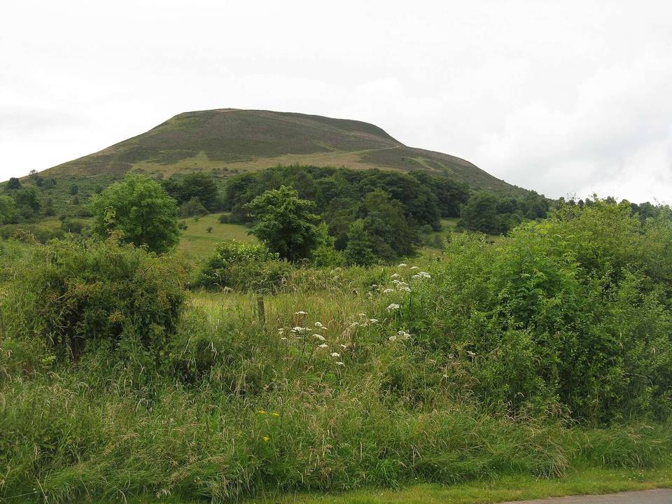
  • Bass Hill at 5.9 km
  • Brotherstone Hill near 13 km
  • Highest point 233 m at 72.6 km
  • Scott's View near 9.1 km

Along the route

Measured from the recorded track and OpenStreetMap.

Places passed

  1. Eildon 3.1 km
  2. Newtown St Boswells 4.2 km
  3. Hawkslee 4.7 km
  4. Holmes Farm 5 km
  5. Dryburgh Mains 5.9 km
  6. Dryburgh 6.1 km
  7. Bemersyde 8.4 km
  8. Halidean Mill 9.5 km
  9. Redpath 10.4 km
  10. Craig House 11.8 km
  11. Brotherstone 12.9 km
  12. Third 13.1 km
  13. West Third 15.9 km
  14. Smailholm 16.6 km
  15. Hardiesmill Place 24.2 km
  16. Fallsidehill 25.6 km
  17. Hume Orchard 27 km
  18. Hume 28.4 km
  19. Coldside 29.5 km
  20. Todrig 30.4 km
  21. Old Greenlaw Farm 32 km
  22. Old Greenlaw 32.4 km
  23. Elwartlaw 33.7 km
  24. Cleughhead 36.7 km
  25. Charterhall 37.9 km
  26. Fogomoor 38.2 km
  27. Fogo 40 km
  28. Caldra 40.4 km
  29. Ladyflat 41.4 km
  30. Gavinton 43.1 km
  31. Langton Mill 44.5 km
  32. Grueldykes 44.9 km
  33. Clockmill 45.6 km
  34. Duns 46.7 km
  35. Duns Law 48.1 km
  36. Birkenside 52.1 km
  37. Burnhouses 53.2 km
  38. Oatleycleugh 53.6 km
  39. Abbey St Bathans 58.4 km
  40. Shannabank 58.9 km
  41. Whiteburn 62 km
  42. Quixwood 65.4 km
  43. Butterdean 67.6 km
  44. Grantshouse 69.4 km
  45. Harelawside 69.9 km
  46. Renton Barns 71 km
  47. Howpark 71.3 km
  48. North Grange 79.1 km
  49. Press Castle 79.9 km
  50. Blackhill 82.4 km
  51. Cairncross 82.6 km
  52. Whitfield 83.7 km
  53. Alemill 85.4 km
  54. Highlaws Farm 87.2 km
  55. Eyemouth 88.9 km
  56. Netherbyres 89.9 km
  57. Biglawburn 90.5 km
  58. Ayton Mains 91.8 km
  59. Ayton 93.4 km
  60. Bleachfield 94.2 km
  61. Peelwalls 94.6 km
  62. Prenderguest 95 km
  63. Whiterig 96.2 km
  64. Moorpark 97.5 km
  65. Burnbank 99.1 km
  66. Foulden Newton 99.9 km
  67. Foulden Bastle 99.9 km
  68. Broadmeadows Home Farm 100.9 km
  69. Clarabad 101.6 km
  70. Paxton North Mains 102.8 km
  71. Paxton 103.6 km
  72. Paxton South Mains 104.1 km
  73. Nabdean 104.8 km
  74. Fishwick 106 km
  75. Tweedhill 107 km
  76. Chainbridge Honey Farm 107.8 km

Climbs

ClimbStarts atLengthGainAverageMaxTop
0 km2.1 km57 m2.8 %4 %155 m
5.7 km2.6 km93 m3.6 %5.8 %169 m
26.2 km2.1 km51 m2.4 %4.7 %200 m
52.5 km1.7 km100 m6 %11 %230 m
58.7 km1.9 km52 m2.8 %4.5 %203 m
69.6 km2.8 km109 m3.9 %7.1 %228 m
90.5 km2 km49 m2.5 %4.2 %66 m
93.7 km2.8 km84 m3 %4.8 %127 m

High point 233 m at 72.6 km; low point 3 m. Passes beneath Quarry Hill, Bass Hill, Bemersyde Hill.

What this ride is like

Measured from OpenStreetMap along the track and the elevation profile.

Roads
63% minor road · 30% main road · 3% quiet street · 2% path
Main roads
32.4 km on main roads without a cycle lane — likely busier
Fast roads
47 km on roads with a limit of 80 km/h or more
Cycle paths
1.9 km on cycle paths or roads with a cycle lane
Main roads used
B6355 (7 km), B6356 (4 km), Howpark Road (4 km), A1107 (4 km)
Surface
Paved throughout
Gradient
23% climbing · 23% descending · 54% flat
Steep sections
2.9 km over 5% · 0.8 km over 8% · 0.4 km over 10% · steepest 500 m averages 10.1% at 54.5 km
Longest descent
5.3 km from 76 km, dropping 87 m

Along the way

Within a few hundred metres of the track, from OpenStreetMap. Opening hours change — treat this as where to look, not a promise.

Longest stretch without a café, shop or water: 25 km, from 21 km to 47 km.

Food, water and shops

  1. 0 kmTwelve Triangles · café · 30 m off route
  2. 0 kmToilets · on the route
  3. 0 kmBoots · pharmacy · 40 m off route
  4. 3.7 kmPetrol station · 110 m off route
  5. 4.3 kmDryburgh Arms · pub · on the route
  6. 6.1 kmToilets · 290 m off route
  7. 21.2 kmToilets · 290 m off route
  8. 46.6 kmToilets · 30 m off route
  9. 46.7 kmThe Co-operative Food · supermarket · 120 m off route
  10. 46.7 kmGeorge Romanes · pharmacy · 70 m off route
  11. 46.8 kmAitchisons · petrol station · 200 m off route
  12. 70.1 kmCedar Cafe · café · on the route
  13. 70.1 kmToilets · 40 m off route
  14. 88.6 kmToilets · 60 m off route
  15. 88.6 kmNorthburn Garage · petrol station · 40 m off route
  16. 88.9 kmCo-op Food · supermarket · 70 m off route
  17. 89.2 kmGeorge Romanes Pharmacy · pharmacy · 110 m off route
  18. 103.6 kmThe Cross Inn · pub · 170 m off route

Worth a stop

  • 0 kmMercat Cross (monument)
  • 5.9 kmBass Hill (peak)
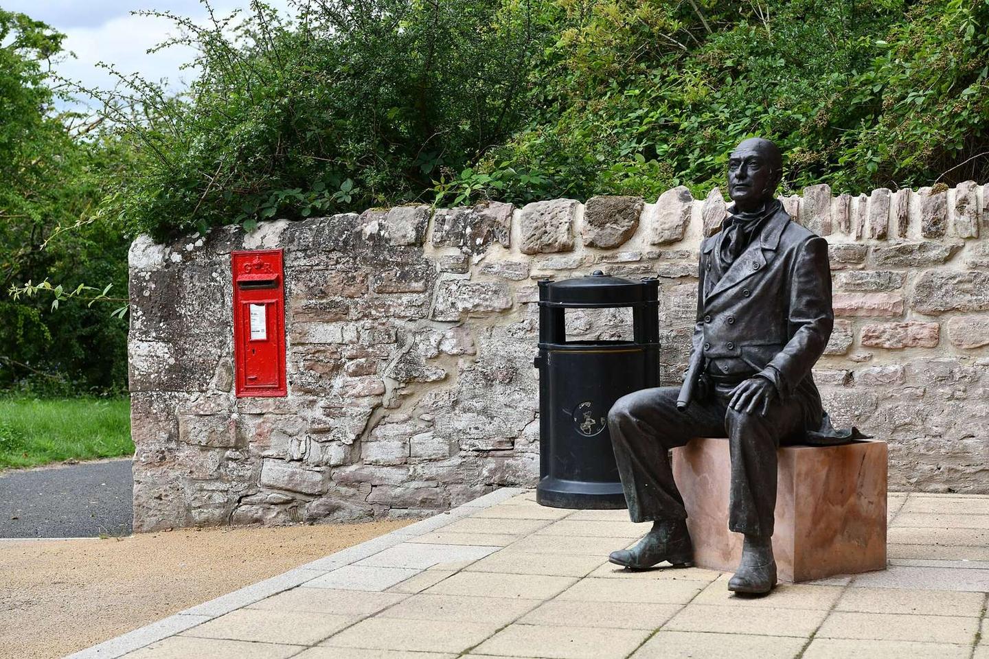
  • 9.1 kmScott's View (viewpoint)
  • 28.4 kmHume Castle (castle)
  • 32.4 kmGreen Law (peak)
  • 46.7 kmMercat Cross (monument)

At the start

  • Twelve Triangles · café · 30 m
  • Abbey Fine Wines Bottle Shop & Cafe bar · café · 20 m
  • Hardies Bikes · bike shop · 40 m
  • Ship Inn · pub · 60 m
  • Alexander Dalgetty & Sons · bakery · 150 m

At the finish

  • The Chain Bridge Honey Farm Bus Café · café · 340 m

Practical information

Surface
Paved
Route shape
Point to point
Riding time
7 h 52 min
Best months
Jun to Sep — daily highs of 16–19 °C in those months

Know before you go

  • 25 km without café, shop or water from 21.2 km to 46.6 km
  • 32 km on main roads without cycle lane
  • 47 km on roads with speed limits of 80 km/h or more
  • Short gravel or unpaved sections totaling 1%

Routes are for inspiration. Roads, surfaces and conditions change — check locally and ride within your limits.

2 photographs from the road

Photo: Michael Garlick · CC BY-SA 2.0 · Wikimedia Commons · Photo: Martin Dawes · CC BY-SA 2.0 · Wikimedia Commons · Photo: M J Richardson · CC BY-SA 2.0 · Wikimedia Commons

Stage of

More rides from Melrose