Cyclists.com

Newport-on-Tay to Dalgety Bay

Newport-on-Tay, Fife, United KingdomRoad

Signed route The waymarked Kingdom Cycle Route (regional route), traced from OpenStreetMap and measured against the terrain model; no member has recorded it yet. Stage 2 of 2 of the Kingdom Cycle Route. Ridden it? Add your recording and photos.

90 km
Distance
569 m
Elevation gain
Hard
Difficulty
Paved
Surface
Download GPXMap

Elevation profile

Total ascent
569 m
Distance
90 km
050100150200m0 km2040608090 km165 m · highest, at 42.9 kmStartFinish

Route overview

This ride suits cyclists looking for a moderate distance with some climbing and mixed surfaces.

Stage 2 of 2 of the Kingdom Cycle Route: 90.3 km from Newport-on-Tay to Dalgety Bay with 569 m of climbing, on the signed route.

Starting at Newport-on-Tay, the route passes through Tayport, Leuchars, Guardbridge, and several small villages including Kincaple, Strathkinness, and Ceres. The route features four climbs, the longest being 3.3 km with a gain of 62 m near Ceres. The highest point is at 165 m around 42 km into the ride. The first half of the route contains 58% of the ascent. The roads vary, with 37% on minor roads, 17% on cycle paths, and 16% on quiet streets. There are 9.3 km on main roads without cycle lanes and 25.1 km on roads with speed limits over 80 km/h, so care is needed on those sections. Gravel or unpaved surfaces make up 14% of the route with some track and path sections as well.

Highlights

  • Climbs near Guardbridge and Ceres
  • Highest point at 165 m near Bowden Hill
  • Passes villages: Tayport, Leuchars, Kirkcaldy
  • Longest descent of 4 km starting near Sinclairtown

Along the route

Measured from the recorded track and OpenStreetMap.

Places passed

  1. Tayport 4.6 km
  2. Leuchars 18.9 km
  3. Guardbridge 21.6 km
  4. Kincaple 23 km
  5. Strathkinness 25 km
  6. Kemback Bridge 30.1 km
  7. Pitscottie 32.5 km
  8. Ceres 34.8 km
  9. Craigrothie 37 km
  10. Chance Inn 38 km
  11. Burnturk 43.9 km
  12. Star 48.9 km
  13. Markinch 52.7 km
  14. Glenrothes 54.5 km
  15. Woodside 55 km
  16. Pitteuchar 55.4 km
  17. Coaltown of Balgonie 56.6 km
  18. Thornton 58.7 km
  19. Smeaton 63 km
  20. Gallatown 63.3 km
  21. Sinclairtown 63.8 km
  22. Pathhead 64.4 km
  23. Hayfield 65.2 km
  24. Port Brae 65.7 km
  25. Kirkcaldy 66.1 km
  26. Linktown 67.7 km
  27. Seafield 68.3 km
  28. Kinghorn 73.3 km
  29. Pettycur 74 km
  30. Burntisland 77.7 km
  31. Aberdour 82.5 km
  32. Dalgety Bay 87 km

Climbs

ClimbStarts atLengthGainAverageMaxTop
22.2 km2.8 km76 m2.8 %3.7 %87 m
29.4 km2.1 km48 m2.4 %3.7 %56 m
35.6 km3.3 km62 m1.9 %3.9 %138 m
67.5 km3.2 km93 m2.9 %4.3 %98 m

High point 165 m at 42.1 km; low point 1 m. Passes beneath Tofts Law, Tullo Braes, Hare Law.

What this ride is like

Measured from OpenStreetMap along the track and the elevation profile.

Roads
37% minor road · 17% cycle path · 16% quiet street · 11% main road
Main roads
9.3 km on main roads without a cycle lane — likely busier
Fast roads
25.1 km on roads with a limit of 80 km/h or more
Cycle paths
17.1 km on cycle paths or roads with a cycle lane
Main roads used
B939 (5 km)
Surface
85% paved · 14% gravel or unpaved
Gradient
18% climbing · 18% descending · 63% flat
Longest descent
4 km from 63.8 km, dropping 87 m

Along the way

Within a few hundred metres of the track, from OpenStreetMap. Opening hours change — treat this as where to look, not a promise.

Food, water and shops

  1. 0 kmFig & Fromage · café · on the route
  2. 4.4 kmToilets · on the route
  3. 4.6 kmRowlands Pharmacy · pharmacy · 130 m off route
  4. 21.1 kmTindal’s Café · café · 40 m off route
  5. 32.5 km2 Wheel Care · bike shop · 60 m off route
  6. 52.4 kmWater point · 240 m off route
  7. 52.5 kmDears Pharmacy · pharmacy · 50 m off route
  8. 52.8 kmToilets · 40 m off route
  9. 57.1 kmLeslie Bike Shop · bike shop · 50 m off route
  10. 63 kmAsda · petrol station · 90 m off route
  11. 64.8 kmPathhead Pharmacy · pharmacy · 170 m off route
  12. 66.1 kmGreener Kirkcaldy Active Travel Hub · bike shop · 190 m off route
  13. 67.5 kmToilets · 40 m off route
  14. 73.4 kmTornado Bagel · café · 50 m off route
  15. 77.4 kmTop Up Tap · drinking water · 50 m off route
  16. 77.6 kmCo-op Food · supermarket · 100 m off route
  17. 81.4 kmDrinking water · 140 m off route
  18. 82 kmDave's Bike Shed · bike shop · 200 m off route

Need to bail out?

  • 19.9 kmLeuchars (station), 440 m off route
  • 52.9 kmMarkinch (station), 60 m off route
  • 59.1 kmGlenrothes with Thornton (station), 70 m off route
  • 66.1 kmKirkcaldy (station), 740 m off route
  • 73.5 kmKinghorn (station), 90 m off route
  • 82.4 kmAberdour (station), 50 m off route

Whether bikes are carried depends on the service — check before relying on it.

Worth a stop

  • 29.4 kmDairsie Castle (castle)
  • 40.7 kmLime kiln (ruins)
  • 52 kmStob Cross (monument)
  • 75.2 kmKing Alexander III monument (monument)
  • 78.2 kmRossend Castle (castle)
  • 82.2 kmAberdour Castle (ruins)

At the start

  • Fig & Fromage · café · 20 m
  • Manna Coffee · café · 110 m
  • Spar · convenience store · 10 m
  • Ballintaggart · bakery · 110 m
  • Newport Hotel · pub · 40 m

At the finish

  • Numark Pharmacy · pharmacy · 520 m

Stay after this ride

  • Aberdour Hotel · hotel · 3.8 km from the finish
  • Peartree House B And B · guest house · 3.8 km from the finish
  • Old Whitehill · guest house · 3.7 km from the finish
  • Boreland Lodge Hotel · hotel · 2.5 km from the finish
  • Fordell Firs · campsite · 2.9 km from the finish

Practical information

Surface
Paved
Route shape
Point to point
Riding time
6 h 27 min
Best months
Jun to Sep — daily highs of 16–18 °C in those months

Know before you go

  • 11.9 km without café, shop or water between km 37 and 48.9
  • 9.3 km on main roads without a cycle lane
  • 25.1 km on roads with speed limits of 80 km/h or more
  • 14% gravel or unpaved surface

Routes are for inspiration. Roads, surfaces and conditions change — check locally and ride within your limits.

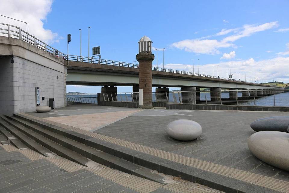
2 photographs from the road

Photo: Scott Cormie · CC BY-SA 2.0 · Wikimedia Commons · Photo: Euan Nelson · CC BY-SA 2.0 · Wikimedia Commons

Stage of