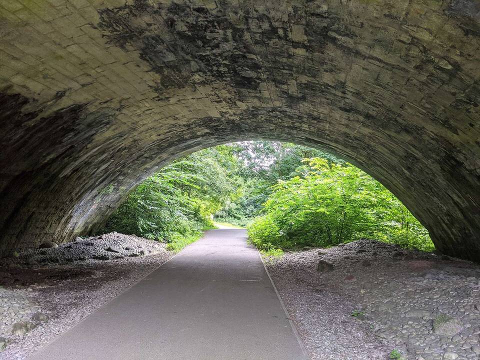
Strathkelvin Railway Path
- 23 km
- 51 m
- Easy
- Paved
Elevation profile
- 51 m
- 23 km
Route overview
Suitable for riders seeking a mostly flat 23 km route with low climbing and mixed paved and gravel surfaces.
Strathkelvin Railway Path is a 23.4 km point-to-point ride in Stirling from Strathblane to Glenboig.
The ride starts in Strathblane at 93 m elevation, descends gently with minimal climbing to 36 m at 11.6 km. The route follows mostly cycle paths (20.2 km) and paths (1.3 km), with 1.1 km on minor roads and 0.8 km on quiet streets. The surface is mainly paved (77%) with some gravel or unpaved sections (19%). The steepest gradients are very gentle with only 0.1 km over 5% gradient. The route passes settlements including Ballagan Farm at 1.6 km, Lennoxtown at 7.1 km, Milton of Campsie at 9.8 km, and Kirkintilloch just before 13 km. There is a longest stretch without café, shop, or water from 0.1 km to 6.8 km (6.7 km). Facilities include supermarkets at 0.1 km, 9.9 km, and 22.8 km, a café near Milton of Campsie at 9.8 km, a pub near Lenzie at 15.3 km, and a café near Moodiesburn at 19.7 km. Bike shop at 13 km and petrol station at 7.1 km. Lenzie station is a bailout point at 15.1 km. The route finishes at Glenboig with shops, restaurants and a pharmacy. Peaks near the route are Dunglass at 1.3 km, Gallow Hill at 8.6 km, and several hills over 100 m in the last 3 km. The profile is flat to gently rolling with little elevation change overall.
Highlights
- Peak Dunglass at 1.3 km
- Gallow Hill 56 m near 8.6 km
- Close to Hill of Chryston 85 m at 18.6 km
- Near Croft Head 104 m at 22.7 km
Along the route
Places passed
What this ride is like
- Roads
- 86% cycle path · 6% path · 5% minor road · 3% quiet street
- Fast roads
- 1 km on roads with a limit of 80 km/h or more
- Cycle paths
- 20.2 km on cycle paths or roads with a cycle lane
- Surface
- 77% paved · 19% gravel or unpaved
- Gradient
- 5% climbing · 5% descending · 90% flat
Along the way
Food, water and shops
- 0 kmStrathblane Pharmacy · pharmacy · 360 m off route
- 0.1 kmGreens of Strathblane · supermarket · 240 m off route
- 7.1 kmLennoxtown Service Station · petrol station · 270 m off route
- 9.8 kmThe Fells · café · 160 m off route
- 9.9 kmAntermony Road Co-op · supermarket · 90 m off route
- 12.7 kmWell Pharmacy · pharmacy · 220 m off route
- 13 kmChapeau Cycles · bike shop · 240 m off route
- 15.3 kmThe Old Gatehouse · pub · on the route
- 19.7 kmThe Coffee House · café · 290 m off route
- 22.8 kmCostcutter · supermarket · 270 m off route
- 22.8 kmGlenboig Pharmacy · pharmacy · 270 m off route
Need to bail out?
- 15.1 km — Lenzie (station), 730 m off route
Worth a stop
- 1.3 km — Dunglass (peak)
- 4.4 km — Lennox Castle (castle)
- 8.6 km — Gallow Hill (peak, 56 m)
- 19.6 km — Bedlay Castle (castle)
- 22.7 km — Croft Head (peak, 104 m)
At the start
- Greens of Strathblane · supermarket · 270 m
At the finish
- Brickworx Bar & Brasserie · pub · 180 m
- Village Takeaway · restaurant · 190 m
- Costcutter · supermarket · 630 m
- Glenboig Pharmacy · pharmacy · 640 m
- New Wok · restaurant · 650 m
Stay after this ride
- Haüss Coatbridge Aparthotel · hotel · 3.6 km from the finish
- Mondo · hotel · 4.0 km from the finish
Practical information
- Paved
- Point to point
- 1 h 40 min
- Jun to Aug — daily highs of 17–18 °C in those months
Know before you go
- Longest stretch without café or shop 6.7 km from 0.1 km to 6.8 km
- 1 km on main roads with posted limits over 80 km/h
- 19% gravel or unpaved surface on route