Cyclists.com

Atouguia da Baleia – Lourinha via Ferrel

Atouguia da Baleia, Leiria, PortugalRoad

64 km
Distance
521 m
Elevation gain
Moderate
Difficulty
Paved
Surface
Download GPXMap
On the road: Atouguia da Baleia – Lourinha via Ferrel

Elevation profile

Total ascent
521 m
Distance
64 km
050100150m0 km204064 km127 m · highest, at 6.5 kmStartFinish · back at the start

Route overview

Suitable for cyclists comfortable with moderate distance and some moderate climbing.

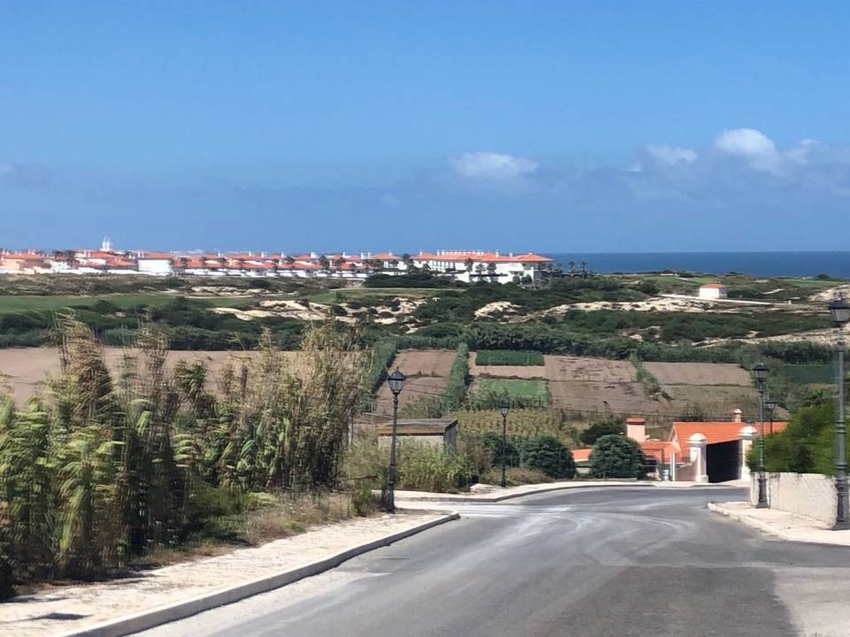
63.6 km loop in Leiria, Portugal, starting and finishing at Atouguia da Baleia with 521 m climbing.

Starting from Atouguia da Baleia, the route heads past Serra d'El-Rei at 6.2 km, climbing early to 128 m at this point, the highest elevation of the ride. It passes through multiple places including Coimbrã, Porto de Lobos, Geraldes and Alto Veríssimo. The profile includes four climbs, the longest starting at 41.4 km with 104 m gain over 4 km. The terrain is 97% paved, mostly on main roads covering 45.2 km, including 19.6 km on EN 247 and 7.9 km on EM 603. There is a 1.2 km track and 0.5 km pedestrian section as well. Climbs are moderate with average gradients mostly below 3.5%, and the steepest 500 m section has a 4.8% grade. There is no significant prolonged steep gradient. Facilities along the route include cafés, restaurants, supermarkets, petrol stations and bike shops, though there is a longest stretch of 8.5 km without café, shop or water between km 42 and 50.5. Toilets are found around km 25 and 39.6. The route loops back to Atouguia da Baleia and goes on to Ferrel and Casais de Mestre Mendo before returning to the start. Traffic is mainly on main and minor roads, with 47.4 km on main roads without dedicated cycle lanes, and 1.7 km on roads with speed limits of 80 km/h or more. The road surface is predominantly paved with only 3% combined gravel or unpaved and unmapped sections.

Highlights

  • Serra d'El-Rei at 6.2 km, highest point 128 m
  • Four moderate climbs with up to 104 m gain
  • Longest named road EN 247 ridden for 19.6 km
  • Facilities including cafés, shops, and bike shop at 50.6 km

Along the route

Measured from the recorded track and OpenStreetMap.

Places passed

  1. Serra d'El-Rei 6.2 km
  2. Coimbrã 10.2 km
  3. Porto de Lobos 12.6 km
  4. Geraldes 16.5 km
  5. Alto Veríssimo 18.1 km
  6. Casal da Murta 21.3 km
  7. Seixal 23.1 km
  8. Casais do Araújo 30.2 km
  9. Marteleira 30.8 km
  10. Miragaia 33.9 km
  11. Nadrupe 35.5 km
  12. Lourinhã 38.7 km
  13. Alto Foz 45.5 km
  14. Atouguia da Baleia 50.5 km
  15. Ferrel 53.9 km
  16. Casais de Mestre Mendo 56.8 km

Climbs

ClimbStarts atLengthGainAverageMaxTop
15.3 km3.2 km72 m2.3 %3.1 %109 m
26.7 km3.2 km80 m2.5 %3.4 %98 m
41.4 km4 km104 m2.6 %4.4 %112 m
55.9 km1.7 km57 m3.5 %5.1 %111 m

High point 128 m at 6.3 km; low point 7 m.

What this ride is like

Measured from OpenStreetMap along the track and the elevation profile.

Roads
72% main road · 12% minor road · 8% quiet street · 4% major road
Main roads
47.4 km on main roads without a cycle lane — likely busier
Fast roads
1.7 km on roads with a limit of 80 km/h or more
Main roads used
EN 247 (20 km), EM 603 (8 km), EN 114 (6 km), EM 578 (4 km)
Surface
Paved throughout
Gradient
28% climbing · 27% descending · 45% flat
Longest descent
4.4 km from 6.5 km, dropping 102 m

Along the way

Within a few hundred metres of the track, from OpenStreetMap. Opening hours change — treat this as where to look, not a promise.

Food, water and shops

  1. 2.1 kmFonte dos Cabreiros · spring · 180 m off route
  2. 6.2 kmA Serrana · café · 70 m off route
  3. 6.2 kmFarmácia Serra · pharmacy · 100 m off route
  4. 6.8 kmMoeve · petrol station · 40 m off route
  5. 16.8 kmSanta Luzia · pharmacy · 280 m off route
  6. 18 kmConvenience store · 60 m off route
  7. 21 kmRestaurante O Moleiro · restaurant · on the route
  8. 25 kmDrinking water · 150 m off route
  9. 26.2 kmDouble AM · café · 30 m off route
  10. 26.4 kmFarmácia Marteleirense · pharmacy · on the route
  11. 28.8 kmChamazul - GPL · petrol station · on the route
  12. 35.5 kmCarlos dos Leitões · restaurant · 60 m off route
  13. 39.5 kmPingo Doce · supermarket · 80 m off route
  14. 39.6 kmToilets · 30 m off route
  15. 40.1 kmRepsol · petrol station · 40 m off route
  16. 51 kmForne da Vila · café · on the route
  17. 51 kmAmanhecer - Aldeia do Mundo · convenience store · on the route
  18. 56.9 kmcafe Mercearia · café · 40 m off route

Worth a stop

  • 5.2 kmParque de Merendas Serra D'El Rei (picnic site)
  • 11.3 kmCastelo de Atouguia da Baleia (castle)
  • 25.4 kmBaloiço adaptado da Lourinhã (attraction)

Practical information

Surface
Paved
Route shape
Loop
Riding time
2–2½ hours riding
Season
Jun, Jul, Aug

Know before you go

  • 47.4 km on main roads without cycle lanes
  • 1.7 km on roads with 80 km/h+ speed limits
  • 8.5 km longest stretch without café, shop or water between km 42 and 50.5
  • 2% gravel or unpaved surface

Routes are for inspiration. Roads, surfaces and conditions change — check locally and ride within your limits.

More rides from Atouguia da Baleia