Cyclists.com

Callander to Paisley

Callander, Stirling, United KingdomRoad

Signed route The waymarked National Cycle Route 7 (Scotland section) (Walk Wheel Cycle Trust), traced from OpenStreetMap and measured against the terrain model; no member has recorded it yet. Stage 2 of 3 of the National Cycle Route 7 (Scotland section). Ridden it? Add your recording and photos.

100 km
Distance
607 m
Elevation gain
Hard
Difficulty
Paved
Surface
Download GPXMap

Elevation profile

Total ascent
607 m
Distance
100 km
0100200300m0 km255075100 km252 m · highest, at 18.2 kmStartFinish

Route overview

Suitable for cyclists capable of moderate climbs over 100 km distance.

Stage 2 of 3 of the National Cycle Route 7 (Scotland section): 100.2 km from Callander to Paisley with 607 m of climbing, on the signed route.

Starting in Callander, the route heads through Invertrossachs at 7.7 km and Aberfoyle at 21.6 km, then passes Gartmore, Dalmary, and Drymen where a bakery and other facilities are available. Early climbs include a 2.1 km section averaging 3.5% gradient up to 166 m and a 3.2 km climb peaking at 252 m. The first half contains about 83% of the climb. From Balloch at 51.7 km the ride continues through Alexandria, Dumbarton, and Clydebank with occasional café and shops. Road surfaces are mainly paved (80%) with some gravel or unpaved sections (16%). The ride covers various road types: cycle paths (36%), minor roads (31%), quiet streets (11%), plus tracks and paths. Main or major roads cover 2 km with 2.2 km on main roads without cycle lanes. The route follows the Forth and Clyde Canal Towpath and the C9 road stretches. Facilities include cafés at 0, 21.6, 36.6, 51.7, 60, 66.9, 73.5, 79.8, 83.9 and 95.5 km, shops and water taps often near those points. There is a longest stretch of 20.7 km at the start without café, shop or water.

Highlights

  • Climb to 252 m near 17.6 km
  • Forth and Clyde Canal Towpath section
  • Passes Drymen and Balloch
  • Ends at Paisley with coach station

Along the route

Measured from the recorded track and OpenStreetMap.

Places passed

  1. Invertrossachs 7.7 km
  2. Aberfoyle 21.6 km
  3. Gartmore 26.2 km
  4. Dalmary 28.1 km
  5. Drymen 36.6 km
  6. Gateside 37.5 km
  7. Gaidrew 39.7 km
  8. Croftamie 40.8 km
  9. Balloch 51.7 km
  10. Jamestown 52.8 km
  11. Alexandria 53.9 km
  12. Bonhill 54.9 km
  13. Renton 56.3 km
  14. Castlehill 58.9 km
  15. Dalreoch 59.7 km
  16. Kirktonhill 60 km
  17. Brucehill 60 km
  18. Dumbarton 60.3 km
  19. Townend 61 km
  20. Silverton 61.5 km
  21. Milton 64.4 km
  22. Bowling 66.5 km
  23. Old Kilpatrick 68 km
  24. Mountblow 69.7 km
  25. Erskine 70.2 km
  26. Dalmuir 71.1 km
  27. Kilbowie 72.6 km
  28. Clydebank 72.7 km
  29. Drumry 73 km
  30. Whitecrook 74.3 km
  31. Renfrew 75.2 km
  32. Yoker 75.5 km
  33. Garscadden 76.3 km
  34. Braehead 77 km
  35. Scotstoun 77.1 km
  36. Whiteinch 78.4 km
  37. Linthouse 79.1 km
  38. Broomhill 79.6 km
  39. Partick 80.5 km
  40. Govan 81 km
  41. Yorkhill 81.2 km
  42. Kelvinhaugh 81.7 km
  43. Finnieston 82.3 km
  44. Glasgow 82.8 km
  45. Plantation 82.9 km
  46. Kinning Park 83.1 km
  47. Cessnock 83.4 km
  48. Bellahouston 84.1 km
  49. Ibrox 84.1 km
  50. Dumbreck 84.7 km
  51. Corkerhill 88.5 km
  52. Pollok 88.7 km
  53. Crookston 90.5 km
  54. Ralston 91.6 km
  55. Hawkhead 93.5 km
  56. Dykebar 93.6 km
  57. Hunterhill 94.3 km
  58. Blackhall 94.3 km
  59. Lochfield 94.5 km
  60. Seedhill 94.7 km
  61. Charleston 94.8 km
  62. Williamsburgh 95.2 km
  63. Paisley 95.5 km
  64. Castlehead 95.5 km

Climbs

ClimbStarts atLengthGainAverageMaxTop
9.9 km2.1 km71 m3.5 %5.9 %166 m
14.4 km3.2 km114 m3.6 %5.8 %252 m
23.3 km2.2 km59 m2.7 %5.9 %81 m
27.4 km4.8 km176 m3.7 %6.3 %209 m

High point 252 m at 17.6 km; low point 1 m. Passes beneath Meall Ear, Doon Hill, Bàt a' Charchel.

What this ride is like

Measured from OpenStreetMap along the track and the elevation profile.

Roads
38% cycle path · 31% minor road · 11% quiet street · 10% track · 1% unmapped
Main roads
2.2 km on main roads without a cycle lane — likely busier
Fast roads
2 km on roads with a limit of 80 km/h or more
Cycle paths
36.3 km on cycle paths or roads with a cycle lane
Main roads used
Forth and Clyde Canal Towpath (5 km), C9 (4 km)
Surface
80% paved · 16% gravel or unpaved
Gradient
11% climbing · 15% descending · 75% flat
Steep sections
2.7 km over 5% · steepest 500 m averages 6.2% at 31.7 km
Longest descent
4 km from 18.3 km, dropping 225 m

Along the way

Within a few hundred metres of the track, from OpenStreetMap. Opening hours change — treat this as where to look, not a promise.

Longest stretch without a café, shop or water: 21 km, from 0 km to 21 km.

Food, water and shops

  1. 0 kmDun Whinny's · café · 30 m off route
  2. 0 kmTop Up Tap · drinking water · 140 m off route
  3. 12.5 kmToilets · 50 m off route
  4. 21.6 kmThe Station · café · 60 m off route
  5. 21.6 kmToilets · on the route
  6. 21.8 kmHighland · petrol station · 120 m off route
  7. 36.6 kmTop Up Tap · drinking water · on the route
  8. 36.6 kmPeloton · bike shop · 50 m off route
  9. 51.7 kmMavi Kitchen and Bar · café · 50 m off route
  10. 52 kmToilets · on the route
  11. 61.2 kmAsda · supermarket · 130 m off route
  12. 66.7 kmToilets · 60 m off route
  13. 66.9 kmMagic Cycles · bike rental · 70 m off route
  14. 72.6 kmToilets · 100 m off route
  15. 76.6 kmSinclair Pharmacy · pharmacy · 30 m off route
  16. 80.3 kmCastlebank Street Service Station · petrol station · 70 m off route
  17. 81 kmTop Up Tap · drinking water · 40 m off route
  18. 88.7 kmCo-op Food · supermarket · 100 m off route

Need to bail out?

  • 52 kmBalloch (station), 110 m off route
  • 60.7 kmDumbarton Central (station), 30 m off route
  • 73.2 kmClydebank (station), 210 m off route
  • 84.6 kmDumbreck (station), 80 m off route
  • 95.4 kmPaisley Canal (station), on the route

Whether bikes are carried depends on the service — check before relying on it.

Worth a stop

  • 0 kmTom Na Chisaig, Motte (archaeological site)
  • 21.7 kmScottish Wool Centre (attraction)
  • 60.6 kmCollege Bow, arch (monument)
  • 67.7 kmAntonine Wall (ruins)
  • 81.7 kmThe Clydeside Distillery (attraction)
  • 95.4 kmSaucel Hill (peak, 41 m)

At the start

  • Dun Whinny's · café · 30 m
  • Mhor Bread · bakery · 90 m
  • The Sandwich Bar · café · 90 m
  • Main Street Bakery · bakery · 110 m
  • Nature's Corner · supermarket · 90 m

At the finish

  • Paisley Canal · station · 90 m
  • Spoons Coffee House · café · 90 m
  • The Wellington · pub · 100 m
  • The_Afton · pub · 140 m
  • Enzo's · fast food · 100 m

Stay after this ride

  • Watermill · hotel · 380 m from the finish
  • My Motel · hotel · 550 m from the finish
  • Broadstone House · guest house · 360 m from the finish
  • Ashtree House Hotel · hotel · 700 m from the finish

Practical information

Surface
Paved
Route shape
Point to point
Riding time
7 h 09 min
Best months
Jun to Aug — daily highs of 17–18 °C in those months

Know before you go

  • Longest stretch without café, shop or water is 20.7 km from 0 km
  • 2.2 km on main roads without cycle lane
  • 2 km on fast roads (80 km/h+)
  • 16% gravel or unpaved surface

Routes are for inspiration. Roads, surfaces and conditions change — check locally and ride within your limits.

2 photographs from the road

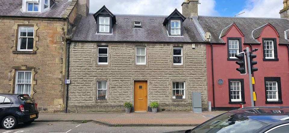
Photo: Drkirstyross · CC BY-SA 4.0 · Wikimedia Commons · Photo: Richard Sutcliffe · CC BY-SA 2.0 · Wikimedia Commons · Photo: Peter Wood · CC BY-SA 2.0 · Wikimedia Commons

Stage of