Cyclists.com

Coast to Coast: Sharjah to Al Aqah

Sharjah, Hajar Mountains, United Arab EmiratesRoad

216 km
Distance
968 m
Elevation gain
Hard
Difficulty
Paved
Surface

Elevation profile

968 m over 216 km

Route overview

A long day for endurance riders: 215.8 km with only 968 m of climbing, so pacing and heat management matter more than gradient.

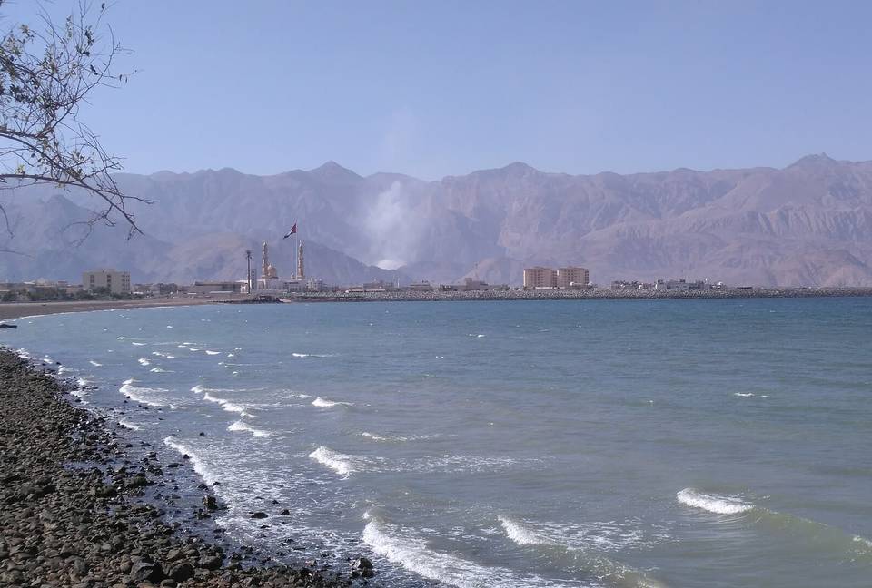
A 215.8 km point-to-point crossing of the UAE from Sharjah on the Gulf coast, over the Hajar Mountains to Al Aqqah on the Gulf of Oman.

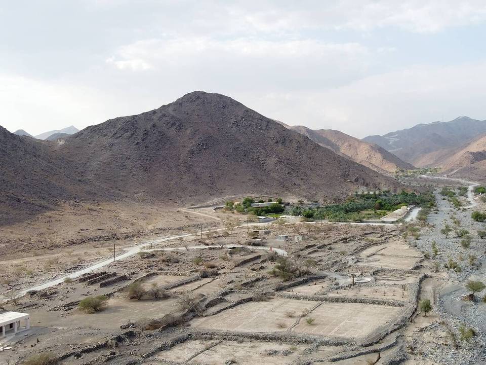
The ride starts in Sharjah and spends its first 25 km threading the coastal city, passing Al Mamzar and Al Nahda, then Al Khan, Al Khalidiyah, Al Majaz and Al Qasimia, where almost all the cafés and restaurants on the route are clustered. Beyond Al Mizhar 3 and Al Ttay the built-up edge gives way to open ground at Qatah (50.4 km) and the town of Milehah at 76.1 km. The climbing is concentrated in the middle. A 3.1 km rise at 2.5% average begins at 90.1 km and tops out at 315 m, and a second 2.8 km at 2.3% follows from 95.7 km to 404 m. The high point of the route, 437 m, comes at 99.1 km, with 69% of the day's 968 m of gain already banked by halfway. From there the road drops through Munay, Al Qilē'ī and Wahala to the eastern coast, reaching the route's low point of -9 m at 148.2 km near Kalba. The final stretch runs north along the shore through Qurayyah, Mirbah, Khor Fakkan, Al Badīyah and Sharm to finish at Al Aqqah.

Highlights

  • High point of 437 m at 99.1 km in the Hajar Mountains
  • Two steady mid-route climbs to 315 m and 404 m
  • Sea-level finish on the east coast at Al Aqqah
  • Coast-to-coast: Sharjah to the Gulf of Oman

Along the route

Measured from the recorded track and OpenStreetMap.

Places passed

  1. Al Nahda 2.3 km
  2. Al Khan 7.6 km
  3. Al Khalidiyah 11.2 km
  4. Al Layyah 12 km
  5. Al Majaz 15.1 km
  6. Al Jubail 17.6 km
  7. Al Gharb 18 km
  8. Al Soor 18 km
  9. Al Qasimia 18.6 km
  10. Oud Al Muteena 29 km
  11. Al Mizhar 3 30.9 km
  12. Al Badaia 40.4 km
  13. Al Ttay 40.4 km
  14. Qatah 50.4 km
  15. Milehah 76.1 km
  16. Munay 111.3 km
  17. Al Qilē'ī 117.3 km
  18. Minazif 118.2 km
  19. Wahala 136.1 km
  20. Al ‘Ayn al Ghumūr 142.4 km
  21. Al Saaf 151.5 km
  22. Al Ghail 151.5 km
  23. Al Maqt'a 153.5 km
  24. Al Quala'a 155.6 km
  25. Khawr Kalba 155.6 km
  26. Al Mafraq 156 km
  27. Al Nighala 156 km
  28. Al Bardi 157.1 km
  29. Al Aoud 157.1 km
  30. Kalba 157.1 km
  31. Al Sidrah 157.5 km
  32. Al Bateen 157.5 km
  33. Al Qadesia 157.5 km
  34. Hitteen 158.4 km
  35. Al Musalla 158.4 km
  36. Al Khuwair 158.4 km
  37. Dhyatt 159 km
  38. Al Mughaider 159.5 km
  39. Al Mahatta 159.5 km
  40. Al Bhaies 160 km
  41. A'quola 160 km
  42. Darweshia 160.5 km
  43. Al Husen 160.5 km
  44. Suhaila 160.9 km
  45. Sour Kalba 161.8 km
  46. Rughaylat 163.1 km
  47. Al Gurfaa 164.5 km
  48. Ghalala 165.5 km
  49. Safad 165.5 km
  50. Owaid 166.3 km
  51. Al Faseel 167.2 km
  52. Al Sharia 169.1 km
  53. Al Sharia 1 169.1 km
  54. Al Hilal 169.9 km
  55. Sakamkam 169.9 km
  56. Ishwais 171.2 km
  57. Qurayyah 180.8 km
  58. Sha'biyyāt Qirat 182 km
  59. Mirbah 182.3 km
  60. Madha 183.6 km
  61. Al Qadsia 190 km
  62. Al Yarmouk 190.3 km
  63. Al Burdi 190.8 km
  64. Al Khaledya 192.4 km
  65. Al Hutain 194 km
  66. Al Rifa'a 194 km
  67. Khor Fakkan 194 km
  68. Al Hayawah 194.5 km
  69. Al Mudaifi 194.9 km
  70. Lulayyah 198.7 km
  71. Zubarah 200 km
  72. Al Badīyah 203.5 km
  73. Nehay 204.4 km
  74. Haqil 204.7 km
  75. Sharm 207.2 km
  76. Al Aqqah 210.9 km

On the road

  • Roadhouse American Diner (Restaurant) 6.2 km
  • QasrAlSultan (Restaurant) 8 km
  • Starbucks Cafe (Café) 8.4 km
  • Filli (Café) 8.4 km
  • Safeer Al Sham Restaurant (Restaurant) 8.8 km
  • Казань (Restaurant) 11.2 km
  • al hariri restaurant (Restaurant) 13.3 km
  • Five star multi cuisine (Restaurant) 13.3 km
  • Starbucks (Café) 13.3 km
  • papa roti (Café) 13.3 km
  • sol restaurant (Restaurant) 13.3 km
  • Tim Hortons (Café) 13.3 km

Climbs

Starts atLengthGainAverageMaxTop
90.1 km3.1 km78 m2.5 %4.4 %315 m
95.7 km2.8 km62 m2.3 %3.7 %404 m

High point 437 m at 99.1 km; low point -9 m.

Practical information

Surface
Paved
Route shape
Point to point
Riding time
7½–10½ hours riding
Season
November, when the two recordings show 23-24°C.

Know before you go

  • No cafés or shops listed after 25.6 km — carry food and water
  • Route low point of -9 m at 148.2 km; long flat coastal run to the finish

Routes are for inspiration. Roads, surfaces and conditions change — check locally and ride within your limits.

11 photographs from the road

More rides from Sharjah