
Cycling in Sharjah
8 cycling routes from Sharjah, United Arab Emirates, 11 to 218 km, 964 km mapped in all, with up to 2,000 m of climbing in a day. Rolling riding (7 m of climbing per km on average), mostly road and gravel routes, 82% of the riding on main roads without a cycle lane. 2 named climbs; the high point is 751 m on Coast to Coast: Sharjah to Dibba. Best months to ride: Dec to Mar.
At a glance
- Routes
- 8
- Lengths
- 11–218 km
- Biggest day
- 2,000 m
- Terrain
- Rolling
- Surface
- Mostly paved
- Bike
- Road bike
- Difficulty
- Easy to Hard
- Named climbs
- 2
- Best months
- Dec to Mar
- Longest gap
- 57 km
- GPX
- Every route
- Around Sharjah11 km21 m ↑Easy·Loop·Dec 2022GPX
- Muahrif Park Initiation32 km60 m ↑Easy·Loop·Dec 2022GPX
- Around Sharjah39 km0 m ↑Easy·Loop·Mar 2024GPX
- Sharjah to Fujairah119 km630 m ↑Hard·One-way·Nov 2020GPX
- Coast to Coast: Sharjah to Khor Fakkan165 km1,295 m ↑Hard·One-way·Nov 2024GPX
- Coast to Coast: Sharjah to Dibba166 km1,718 m ↑Hard·One-way·Mar 2022GPX
- Coast to Coast: Sharjah to Al Aqah216 km1,117 m ↑Hard·One-way·Nov 2020GPX
- Coast to Coast: Sharjah to Khor Fakkan via the Hills218 km2,000 m ↑Hard·One-way·Mar 2023GPX
Know before you go
Added up from the recorded routes and OpenStreetMap; nothing estimated.
- Surface
- Paved almost throughout — 43 km of gravel or unpaved road across the routes.
- Roads
- 82% of the riding on main roads without a cycle lane · 49 km on cycle paths or lanes.
- High point
- 751 m on Coast to Coast: Sharjah to Dibba.
- Climbs
- 2 named climbs.
- Bail-outs
- A railway station or ferry within reach on 1 route.
- No services
- 57 km on Coast to Coast: Sharjah to Khor Fakkan.
- Ridden
- Mar, Oct to Dec, 22–29 °C recorded.
Cycling guide to Sharjah
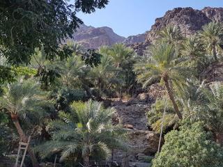
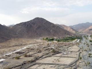
Sharjah is a start point for several extensive point-to-point cycling routes crossing the Hajar Mountains in the United Arab Emirates. Routes include journeys to Al Aqah, Dibba, and Khor Fakkan, covering distances from 165 km to over 217 km. Each route passes through many urban and rural places, including Al Mamzar, Al Nahda, Al Khan, and Khor Fakkan. The climbs range from moderate to challenging, with the highest point recorded at 751 m. Riders can experience varied gradients, with the largest climbs being between 3.4 km and 6.3 km in length.
Most routes are predominantly paved, with 97-98% paved surfaces and minimal gravel or unpaved sections. Cycle paths are rare, with at most 8.3 km noted on one route, and the majority of the distance is on main roads without cycle lanes, up to 186.7 km. The longest stretches without services can be up to 56.8 km. The region has one railway station near one route, offering some transport access. Sharjah's cycling is suited to endurance riders seeking long rides with moderate elevation gain through the Hajar Mountains.
More on best time to ride, terrain
Best time to ride
November and March are recorded months for cycling with temperatures ranging from 22°C to 27°C, making these months the most suitable times to ride from Sharjah.
Terrain
Terrain around Sharjah is characterised by rolling to mountainous profiles with highest elevations reaching 751 m. Climbs vary from shorter ascents of around 3.4 km with average gradients below 3% to longer climbs of over 6 km averaging 6% gradients, with maximum gradients up to 12.3%. The longest climbs and highest points are inland towards the Hajar Mountains.